Support WBUR
Forecast: Frigid Arctic air and snow squalls move into Boston
Winter is about to make itself known. A sharp jolt of Arctic air is set to plunge into New England behind a fast-moving cold front Thursday, bringing gusty winds and quick-hitting snow squalls.
What’s heading to New England is more than just a cold snap — it’s a piece of the polar vortex. That infamous swirl of cold air locked in the Arctic is breaking off just enough to give us a rude reminder that December means business.
Snow squalls: Blink and you’ll miss ‘em
It's not going to be a widespread snowstorm, but don’t let that fool you. These are the kind of fast-moving, 10-minute squalls that darken the sky and hammer the windshield with snow. Squalls then vanish just as quickly, leaving slick roads behind.
Timing for these bursts is tough to nail down, but for southern New England, the prime window runs from 1 to 7 p.m. Some areas may end up with just a dusting, others with a quick inch.
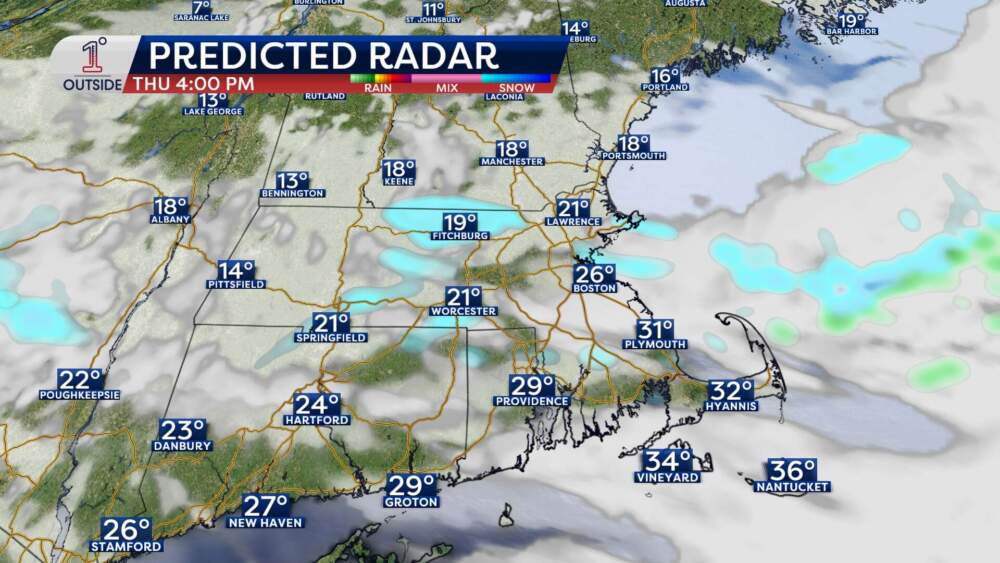
While that doesn’t sound like much snow, remember: It’s the combination of timing, wind and falling temperatures that makes squalls dangerous.
Wind: Strong gusts, isolated damage
The wind will pick up dramatically later on Thursday. What starts as a steady breeze in the 10 to 20 mph range early in the day turns into afternoon gusts up to 40 mph for many. Gusts of 45 mph are possible on Cape Cod.
That wind will bite, and it’ll blow around any snow that falls, too. It will also be strong enough to result in some isolated pockets of damage and outages.
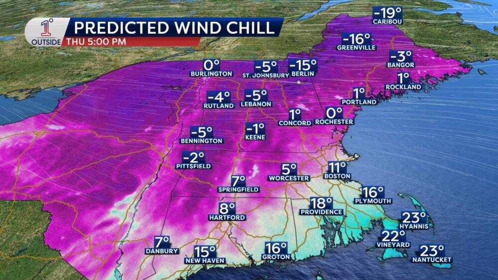
The cold: Real-deal Arctic air
As the front pushes through, temperatures drop sharply. The wind chill will be running in the teens by late afternoon. Many will likely notice it before the workday’s over, especially for those picking up kids from school.
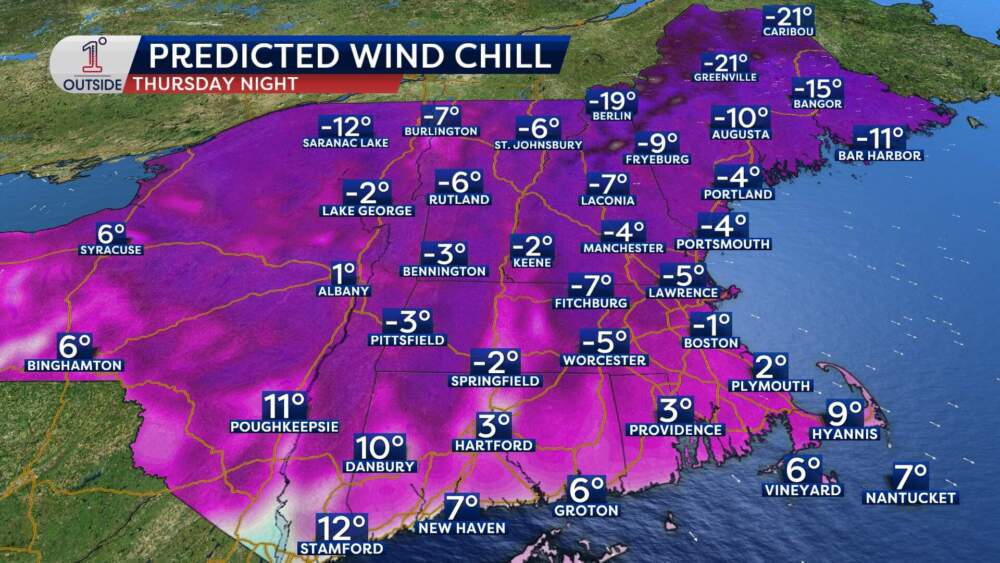
By Thursday night, many areas of New England will feel like it’s below zero, including north and west of Boston. In Boston, expect a low of 12 degrees Thursday night, with a wind chill near 0.
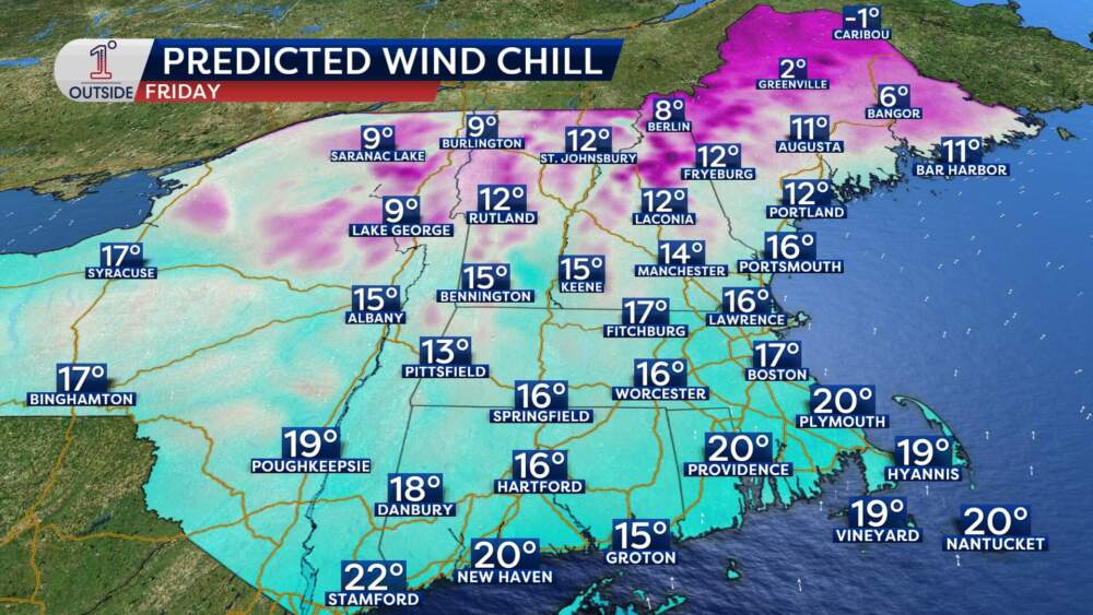
The wind won't be nearly as strong on Friday, but Massachusetts will be stuck in the mid- to upper-20s. But even a slight breeze will make it feel like teens most of the day.
Temperatures will rebound a bit on Saturday and Sunday, back in the 30s to near 40. But don't get used to it: Another shot of cold arrives Sunday night into the start of next week.
Want the latest updates as the front comes through? Track the squalls and temps in the free 1DegreeOutside mobile app.