Support WBUR
Why Boston feels so much colder than usual this winter
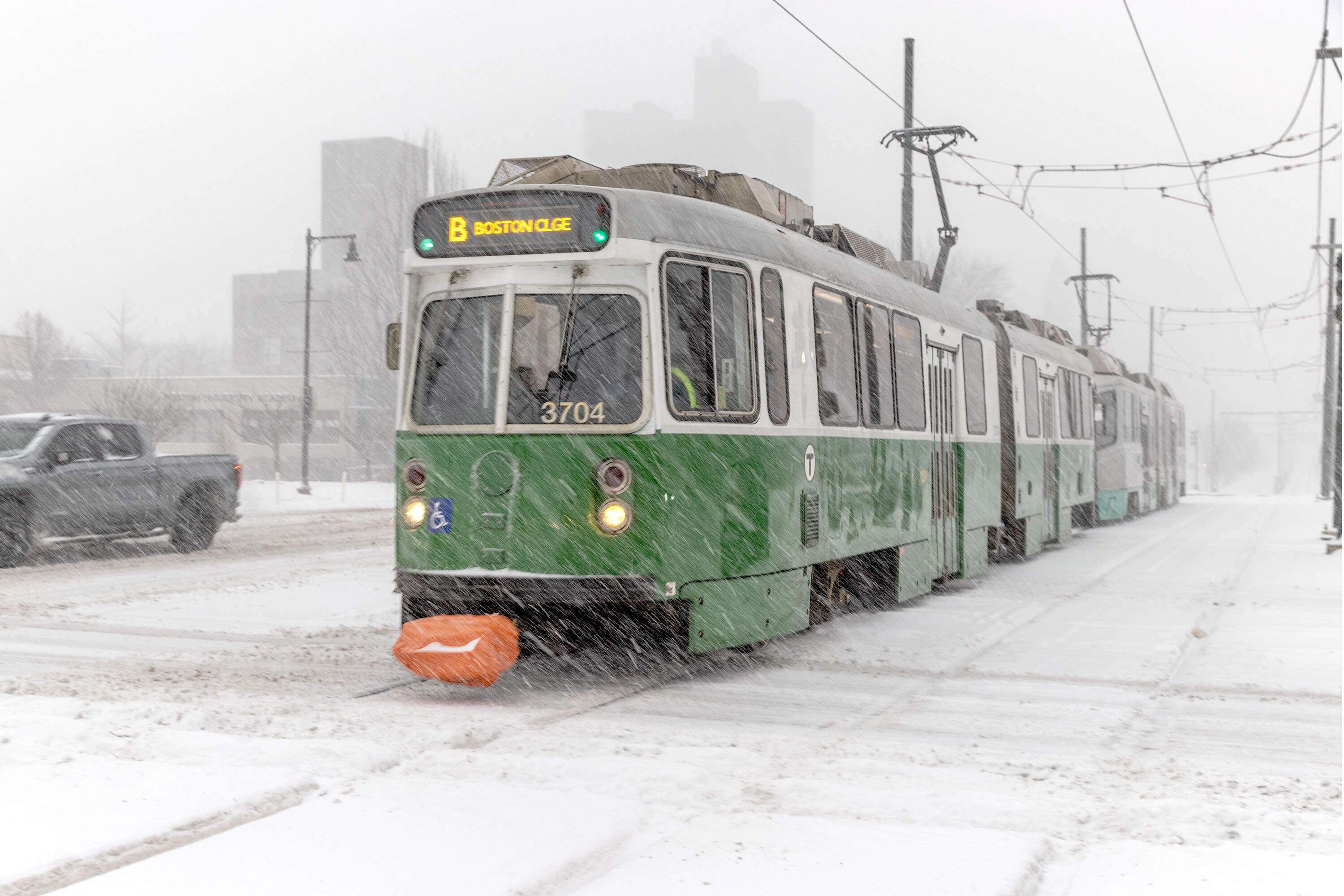
After what felt like an eternal stretch of Arctic weather, Boston is warming up.
The city hit 41 degrees Wednesday, the first above-average high temperature in nearly three weeks. In mid-February, the typical high is in the upper 30s, with overnight lows in the mid 20s. So this isn’t exactly a spring preview, but after a stretch of frigid temperatures, it probably felt that way.
This winter has felt extra cold for Bostonians, and historic data backs up those shivers.
How cold has it been?
Let’s put some numbers behind the feeling.
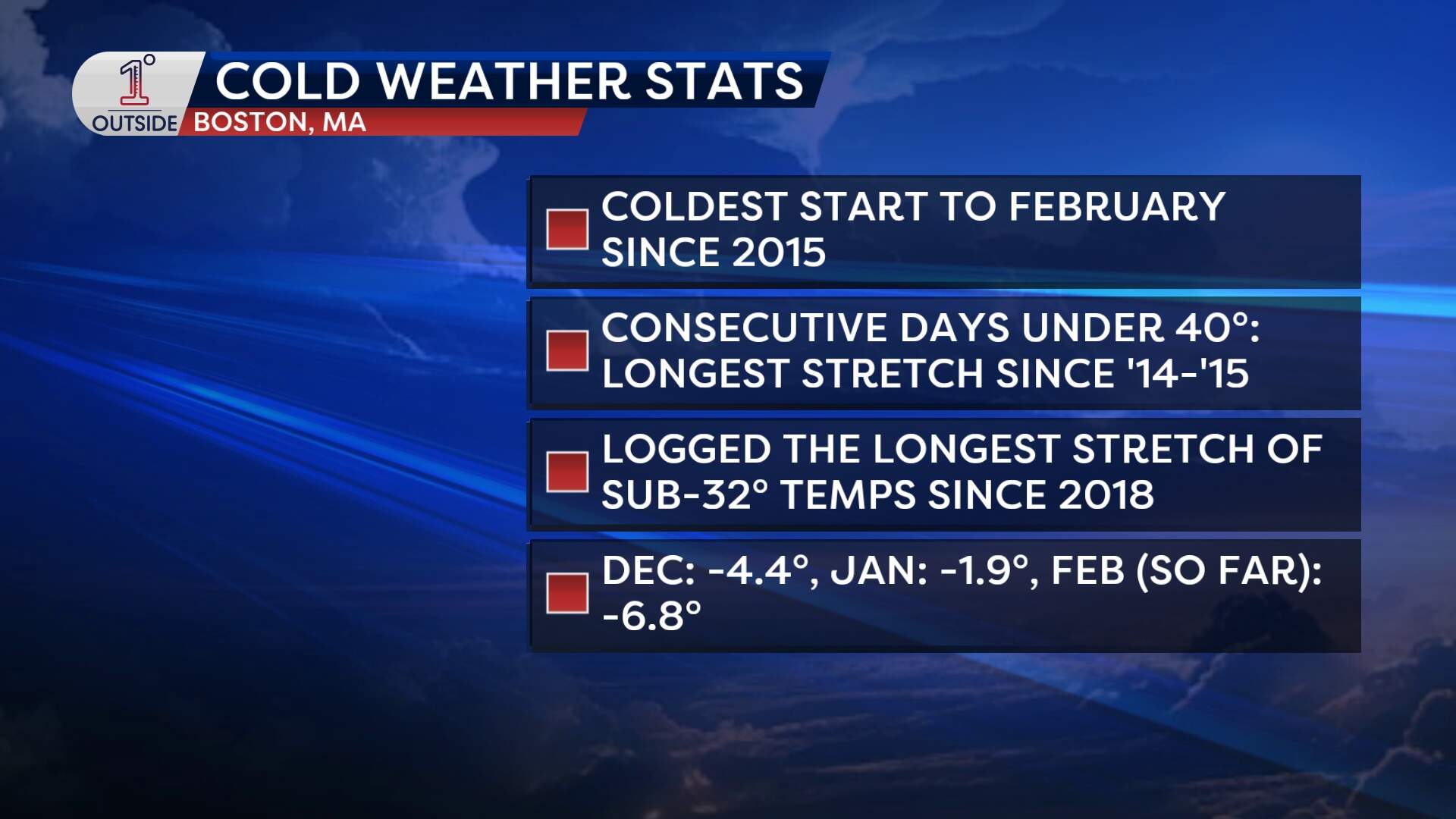
- Dec. 2025 finished 4.4 degrees below average in Boston.
- January came in 1.9 degrees below average for the monthly mean temperature.
- And so far, February is running a striking 6.8 degrees below average.
In fact, this has been the coldest start to February since 2015. Overall, this is shaping up as Boston’s coldest winter since the 2014 to 2015 season. Last winter was technically colder than average, too, but only slightly. This year is in a different category.
Boston also just logged its longest stretch of sub-freezing temperatures (below 32 degrees) since 2018. So while this may not be historic cold, it has been persistent.
Is this the coldest winter ever?
Not even close. When digging through Boston’s climate records, the overwhelming takeaway is that this winter hasn’t been extreme by longterm standards. Compared to a “normal” New England winter, this isn’t wildly out of bounds.
There was one stretch this winter that stands out. The cold snap from late January into early February was the coldest for those specific calendar dates since the early 1960s. That’s notable. It doesn’t mean all-time records were shattered, but it does mean the city revisited a level of cold it hadn’t seen for those dates in more than 60 years.
But Bostonians have experienced some notably mild winters over the past few decades. That has, in some ways, conditioned winter expectations. The city has grown accustomed to more frequent winter days in the 40s and 50s (or warmer), more rain events and shorter-lived cold snaps. This year has felt different because it has been more in line with what a traditional, colder New England winter feels like.
Getting back to normal
Boston is entering a stretch of warmer temperatures compared to what they've been. The polar vortex has relaxed, and there’s no organized deep Arctic air poised to dive south again anytime soon.
But don't expect spring weather yet. Temperatures will likely fluctuate on either side of normal through the end of the month. Expect daytime highs in the 35 to 45 degree range. That’s seasonable, but after weeks of deep chill, it may feel mild.
How about the snow?
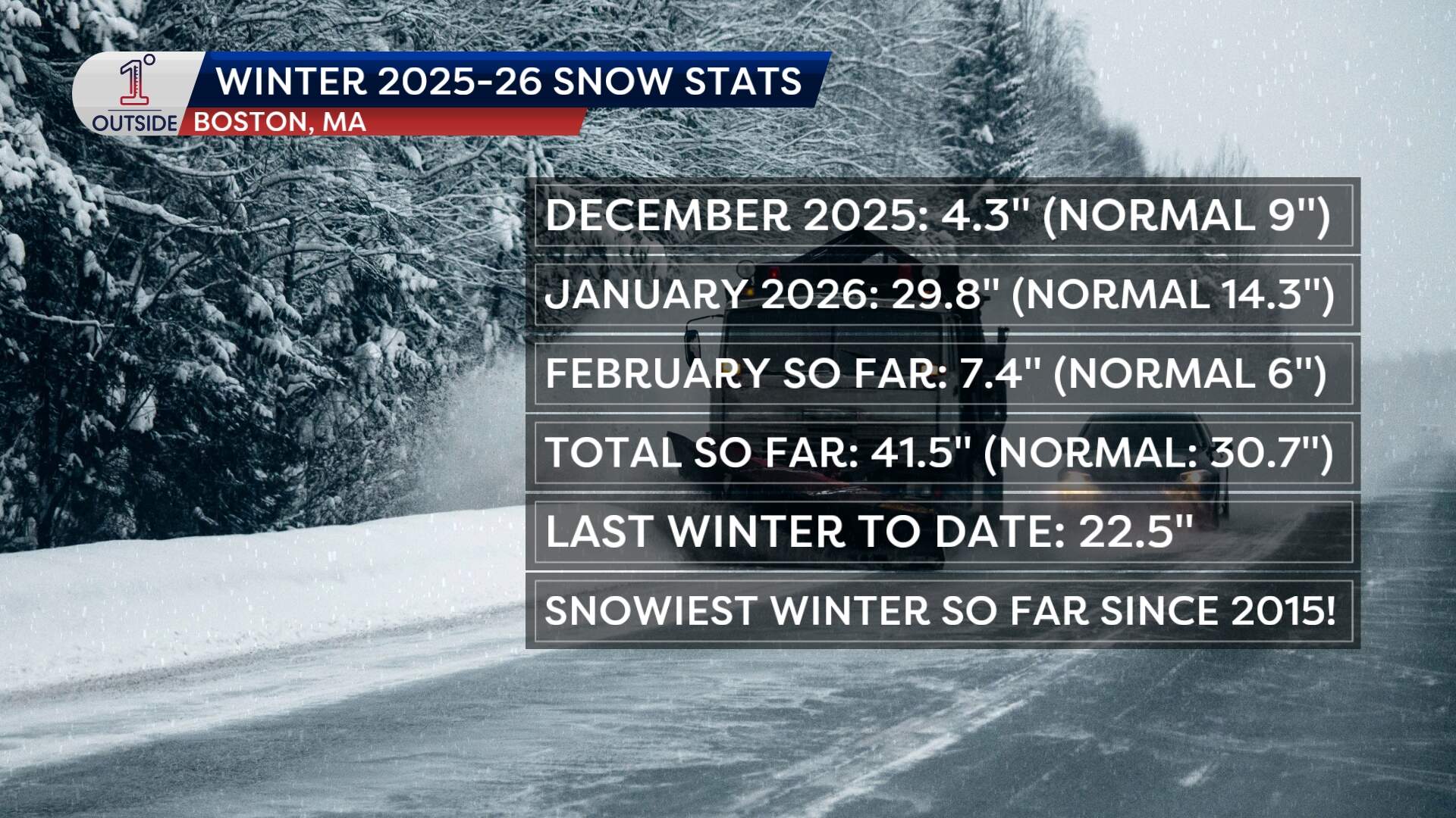
December was quieter for snow lovers:
- Dec. 2025: 4.3 inches
- December average: About 9 inches
January, on the other hand, was a blockbuster month for snow.
- Jan. 2026: 29.8 inches
- January average: 14.3 inches
Much of that total came from the Jan. 25 to 26 storm, which dropped 1 to 2 feet across much of New England. Boston got recorded 23.2 inches from that storm alone.
Despite the cold, Boston's snowfall has been close to average so far this month.
- As of Feb. 12, 2026: 7.4 inches
- Climatological average through Feb. 12: 6 inches
Boston is slightly above the mean for the month, but not dramatically so. For comparison, the city had recorded over a foot of snow by the end of Feb. 2025.
What’s next?
With the jet stream positioned nearby in the coming weeks, Boston will continue to see opportunities for unsettled weather and potential storms. The first chance comes Monday. Right now, it appears the northern and southern stream energy won’t combine in time to produce a meaningful snowfall for the region.
But if the track shifts closer, or the streams interact more efficiently, that could change. It’s something to watch carefully in the coming days.
Get the latest updates at 1DegreeOutside.com or on the free 1DegreeOutside mobile app.
