Support WBUR
Blizzard of 2026 recap: Record snow totals and hurricane force winds
After a few years of relatively quiet winters, the Blizzard of 2026 just reminded us exactly who is in charge: Mother Nature.
Monday wasn’t just a snow day — it was a record-shattering, landscape-altering event. While many in the region were hunkered down listening to the wind howl, history was being made across southern New England
By the numbers: record-breaking snowfall
If it felt like the snow just wouldn't stop, that's because it didn't.
Storm snowfall totals:
- 37.9 inches in Providence
- 17.1 inches in Boston
- 16.2 inches in Worcester
- 11.8 inches in Hartford
The jackpot zone stretched from Rhode Island through southeastern Massachusetts, where totals over 30 inches were common. Cranston, Rhode Island got a whopping 39 inches. In Massachusetts, New Bedford got 37 inches and Kingston received 36 inches.
There are unofficial reports of over 3 feet in some spots. Getting an official measurement was a hero’s errand with the significant blowing and drifting making it impossible to find a level surface.
Providence: The new gold standard
The Blizzard of '78 has been the legendary benchmark in Rhode Island for nearly 50 years. Well, '78 just got moved to second place.
The 37.9 inches recorded at T.F. Green International Airport broke the all-time record for the greatest single snowstorm, surpassing the 28.6 inches from 1978. It also set a new one-day snowfall record (35.5 inches), nearly doubling the previous record of 19 inches set back in 1996.
More than just snow: the damage report
While the snow was the headline for many, the wind was also the story for the South Shore, Cape Cod and Rhode Island. There were hurricane-force gusts in spots with numerous gusts of 55 to 70 mph, leading to extensive damage. As of Tuesday morning, more than 250,000 customers are still without power, including most of Cape Cod.
With trees down and lines tangled, utility crews are working hard, but it’s going to be a multi-day effort to get everyone back on the grid.
The one-two punch: Wednesday's commute
Tuesday is a much-needed quiet day for cleanup, but don't put the shovels away just yet. A quick-moving system is eyeing the area for Wednesday morning.
While this isn't a monster like Monday, the timing couldn't be worse. It’s set to hit right during the morning commute and school start times.
- Timing: 5 to 7 a.m. start, moving west to east. Everything wraps up around noon.
- Temperatures: It starts very cold (teens and single digits), so the snow will be fluffy and stick immediately. As temperatures rise into the 30s, it will turn into a heavier, wet mess.
- Totals: Generally around 1 inch, with slightly more in the Worcester hills (2 to 3 inches).
- The mix: The Cape and South Shore will likely see a changeover to rain by midday, which will limit their accumulations, with a coating to 1 inch in spots.
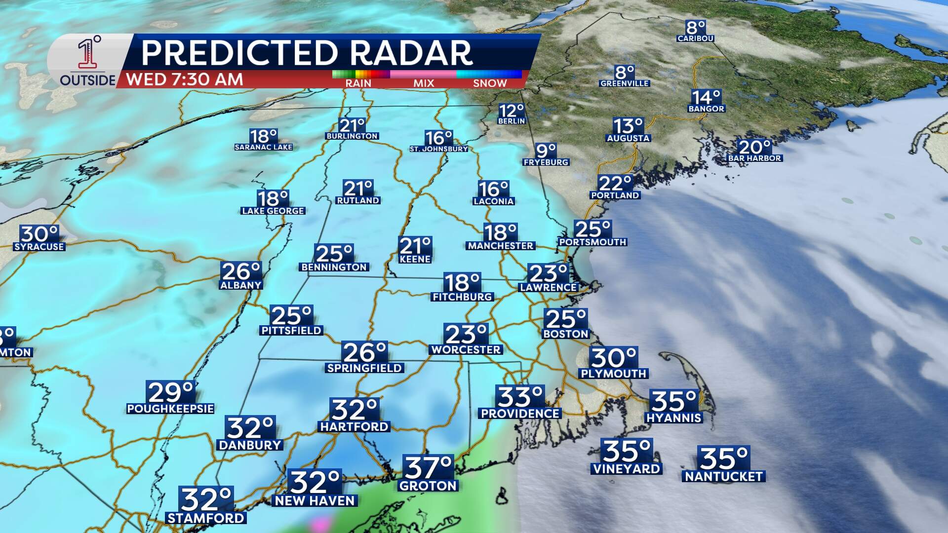
The bottom line
Wednesday morning (5 to 10 a.m.) is going to be slippery with tough travel, reduced visibility and a quick but impactful few hours of snow.
Get the latest updates at 1DegreeOutside.com or on the free 1DegreeOutside mobile app.
