Support WBUR
Warm up, then deep freeze: What weather to watch for this weekend
While it may not look or feel like it right now, we are on the cusp of a new season.
This Sunday marks the start of meteorological spring. While the official vernal equinox is still a few weeks away, climate scientists use March 1 to keep records tidy.
Of course, New England weather isn't exactly checking the calendar. We still have some winter business to attend to first. There's a busy week ahead, ranging from a blood moon to a weekend temperature roller coaster. Here is everything you need to know to navigate the next few days.
The weekend roller coaster: From near 50 to snow
Saturday will be a standout day. After some patchy morning black ice, expect a solid temperature rebound. With a southwesterly breeze, highs will jump well into the 40s, with 50s possible in a few communities. It’s going to be a prime day for melting across the state.
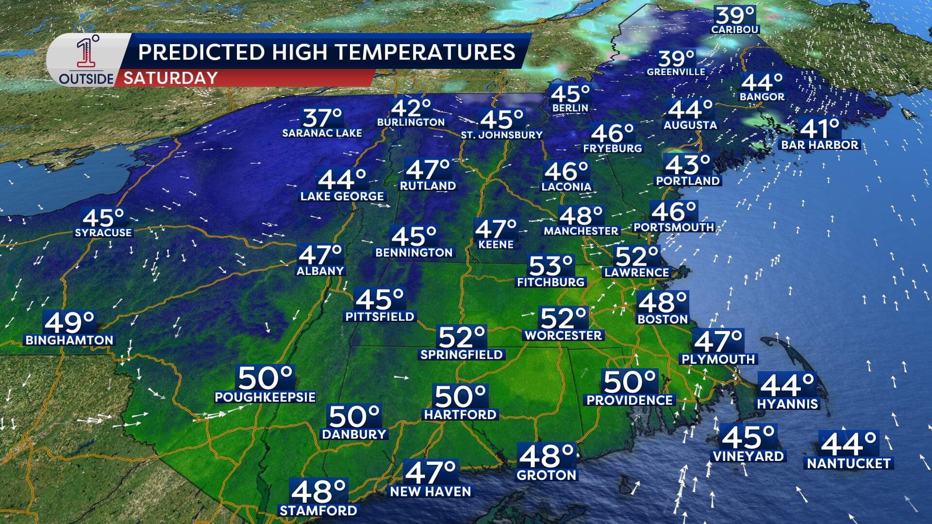
But enjoy the relative warmth while it lasts — a cold front is moving in to crash the party. On Sunday, expect falling temperatures throughout the day. The high for the day (mid 30s) will happen early, with readings dropping steadily as colder air pours in from the north.
The snow factor: As that cold air arrives, pockets of light snow or snow showers will develop, starting around 9 a.m. Sunday and lasting until about 1 p.m. It will be a quick-hitting event.
Accumulation: Expect a coating to an inch. Some worst case scenarios bring 2 inches in spots, mainly in central Mass. This will be a heavy and wet snow, but accumulation is minor.
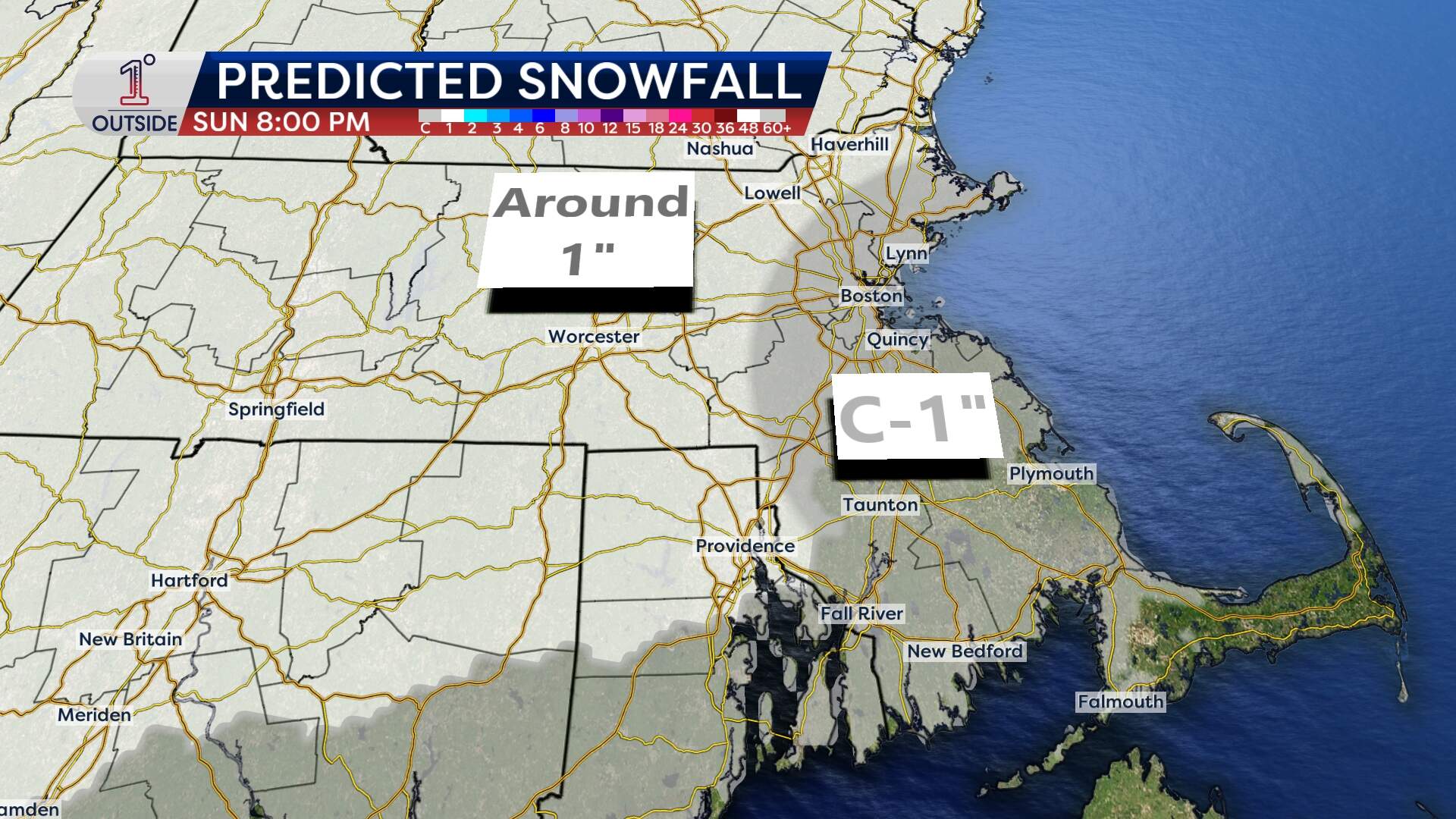
The freeze: Importantly, temperatures will drop to 12 degrees overnight Sunday. Any slush or rain on the roads will freeze solid by 8 p.m. so watch for localized slick spots if you're heading out Sunday night.
Tuesday morning: "Blood moon" lunar eclipse
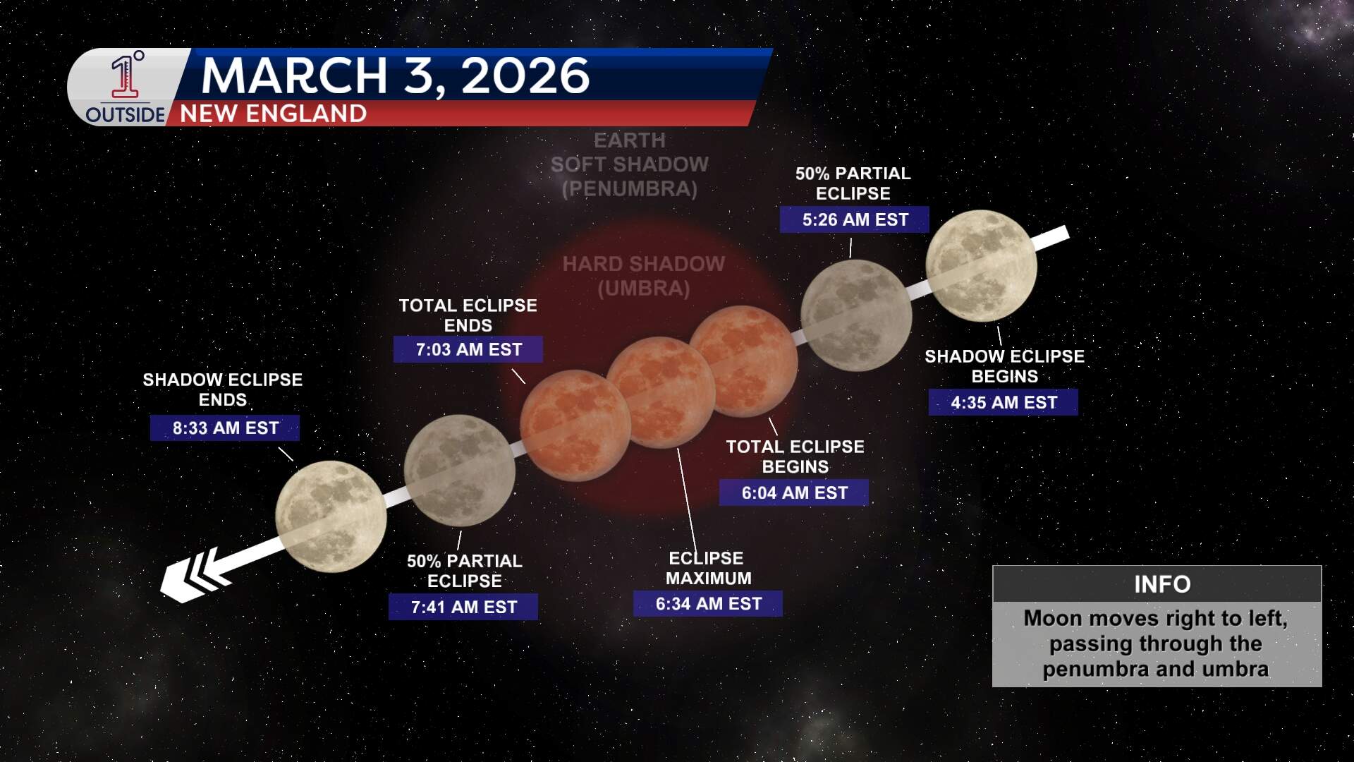
While the weather on the ground is messy, the view in the sky early Tuesday morning will be spectacular. We are set for a total lunar eclipse.
As the moon enters the darkest part of Earth’s shadow, it will turn a deep, rusty red. To get the best view, find a high vantage point with a clear western view. The moon will be setting in the west just as the sun is rising.
The timeline:
- 4:50 a.m.: The "bite." Partial eclipse begins.
- 6:04 a.m.: Totality begins. The moon turns red.
- 6:20 to 6:30 a.m.: The moon sets.
The week ahead: Two storm windows
That front responsible for Sunday's chill isn't going anywhere fast. In fact, it stalls nearby, with multiple waves of low pressure traveling along it in the coming days. That means there are a couple of active windows to watch.
Tuesday into Wednesday: There is a 90% chance of precipitation. Since the region will be on the colder side of the front, snow is a real possibility. Totals, however, are still uncertain. Early models show a range from nothing, to 6 inches.
Thursday into Friday: Another system is lurking with an 85% chance of activity. At this early stage, it looks more like a mix-to-rain or just rain scenario as temperatures oscillate.
We are in that classic shoulder season tug-of-war. Keep the winter gear at the ready.
Get the latest updates at 1DegreeOutside.com or on the free 1DegreeOutside mobile app.
