Support WBUR
How harsh was this winter? Here's what the data says
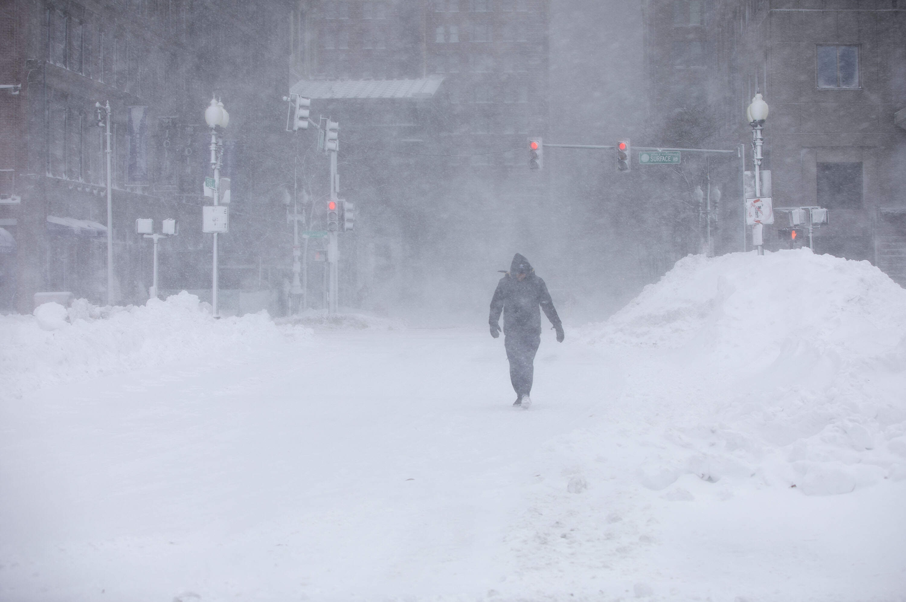
For those who spent the last three months shoveling, shivering and wondering if this winter would make the history books, the data is finally in.
Meteorological winter — defined as December, January and February — has come to a close. The numbers confirm what New Englanders already knew: the winter of 2025-2026 was one to remember.
In a climate era often defined by record warmth, this season was a stark throwback. It was the coldest and snowiest winter the region has seen since the infamous "Snowmaggedon" of 2014-2015.
The exception to the rule
Perhaps the most surprising fact about our winter is that New England was the exception to the rule: much of the rest of the country was wondering where winter went.
The continental U.S. just experienced its second warmest winter on record. While record-breaking warmth dominated the west and the south, the northeast stood as a lonely, frozen outpost.
The paradox
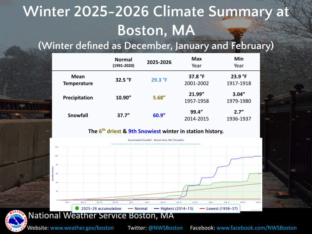
Boston ended the season with a split personality. On one hand, it was the 6th driest winter in station history in terms of liquid precipitation. On the other, it ranked as the 9th snowiest.
How does that happen? It all comes down to the "fluff factor."
Persistent arctic outbreaks kept temperatures consistently cold, averaging about 3 degrees below the mean temperature, making this Boston's 19th coldest winter on record. When storms hit this frigid air, the snow had a much lower water content than our usual heavy, wet New England "cement" snow. Instead, the region often got a lighter, powdery consistency.
While December started slow and lean (only 4.3 inches of snow compared to the 9-inch average), the atmosphere made up for lost time during the second half of the season. The bulk of our accumulation came from two big events:
- The late January blockbuster (Jan. 25-26): Boston’s biggest storm of the season, dumping 23.2 inches.
- The Feb. 23 blizzard: A historic blast that added another 17.1 inches to the tally.
Record-breaking neighbors
Providence, Rhode Island, experienced its snowiest winter ever recorded, fueled largely by the historic blizzard that dropped over three feet of snow on the city.
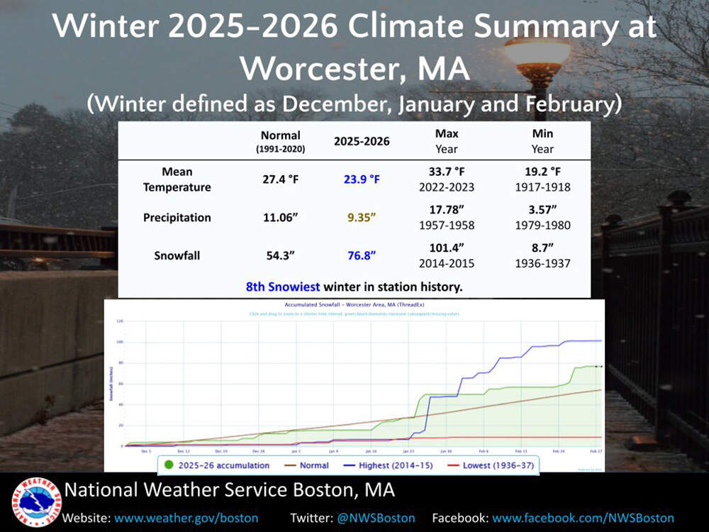
Worcester notched its 8th snowiest winter on record, also its most significant since 2014-2015.
The spring outlook: A weather seesaw
As March rolls along, the transition to spring looks anything but smooth. While Boston recently enjoyed a record-breaking stretch of warmth, a winter chill is about to flex its muscle again.
So far, Boston has recorded 1.6 inches of snow this month, below the March average of 9 inches. Boston will likely end the month below average for snow, but it takes only one decent sized storm to tip the scales.
The second half of March is shaping up to be somewhat volatile. In classic early spring fashion, temperatures will fluctuate substantially, with a near or below-average two-week stretch on the horizon.
- The jet stream: The Climate Prediction Center is calling for "equal chances" of above and below-normal temperatures and precipitation. This suggests an active jet stream and "seesaw" weather patterns.
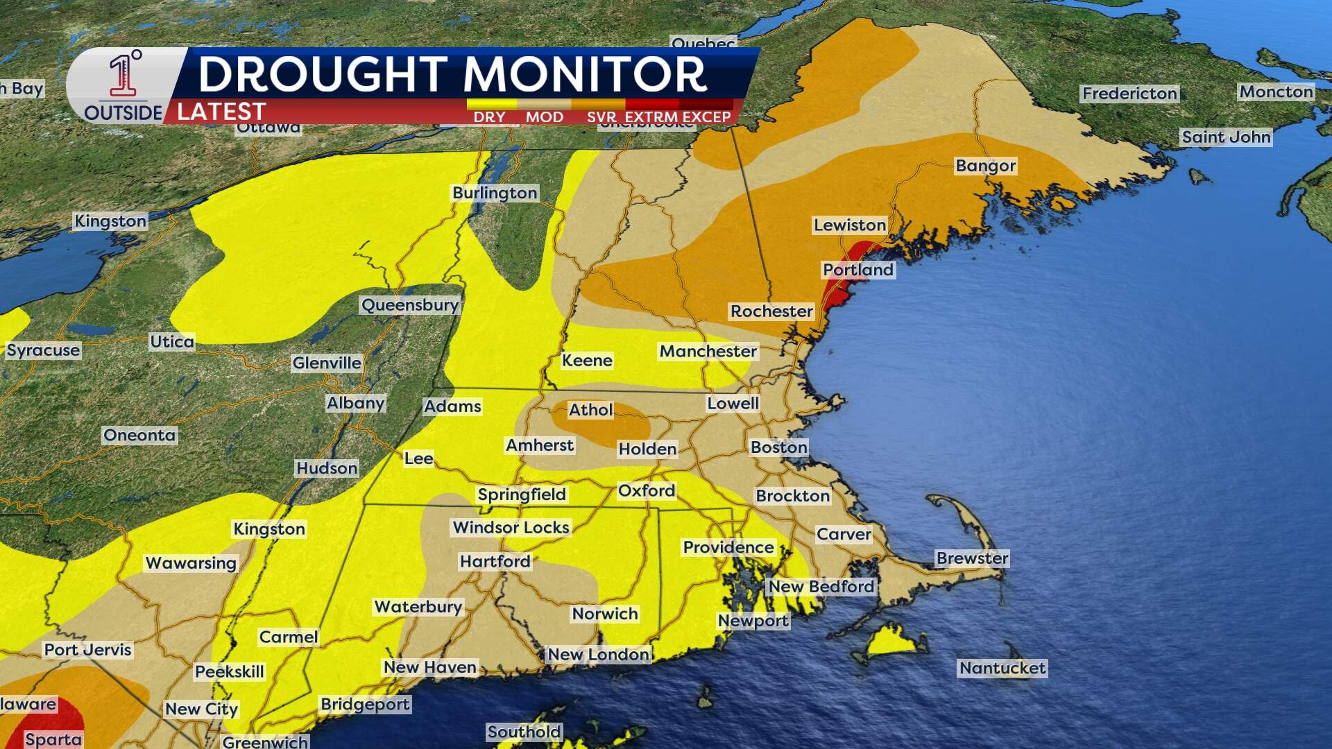
- Drought vs. deluge: Parts of New England remain in moderate to severe drought. While more precipitation is needed, there is a catch: if it arrives all at once during a warm spike, the potential for ice jams northern New England and localized flooding increases significantly.
The winter of 2025-2026 was a reminder that Mother Nature can still deliver a more classic winter to New England. As Boston moves through spring, the "active" pattern suggests that while the shovels might get a rest, the umbrellas will stay busy.
Get the latest updates at 1DegreeOutside.com or on the free 1DegreeOutside mobile app.
